Take a trip with Google Earth
11 October 2006
7:00 AM
If you haven’t yet, you should check out Google Earth, a spinning, zooming, 3D visualization of satellite imagery. It makes the world seem simultaneously very large and very small. Large because there is so much detail to see; small because you can fly from one city to another just by typing a name. You can see a bird’s-eye view of the Grand Canyon, New York City, the Golden Gate Bridge, the Vatican, or your house. There are also dozens of informational layers that you can activate like street names, 3D buildings, points of interest, and comments contributed by other users.
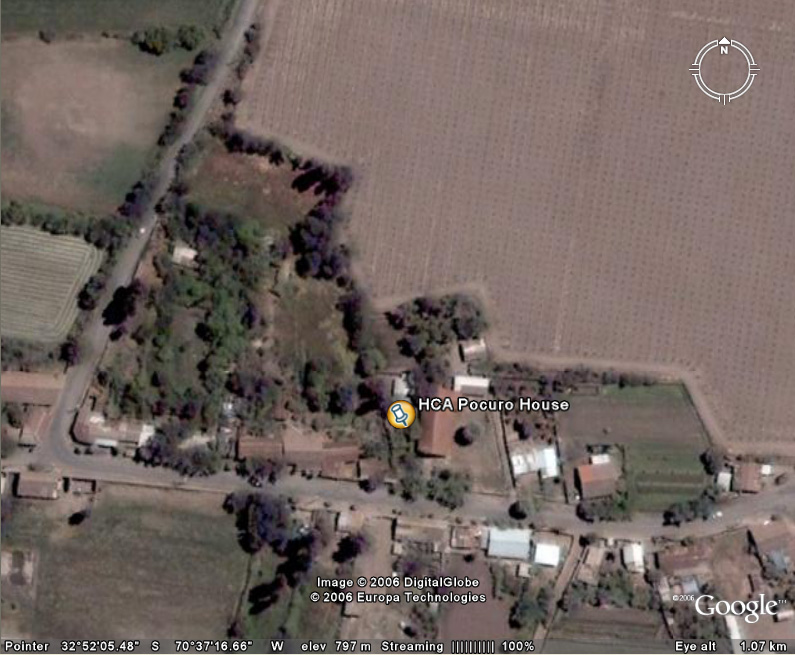
Alas, much of that information isn’t available for most countries. There isn’t, for example, any way to see the street names of cities in Chile. For that reason, it took me some time to locate the associate houses in Google Earth. After becoming familiar with the area, I searched for Los Andes, the nearby city, and then traced the bus route visually until I arrived at our house next to the chapel. With Caitlin’s help to navigate the Santiago street plan, we did the same to find the associate house in Peñalolén. Once you have located a place, you can bookmark it so anyone who has the bookmark file can return. That’s just what we did. If you open either of the following two files in Google Earth, your globe will spin until you arrive at our house.
- Santiago associate house (on Ictinos in Peñalolén)
- Pocuro associate house (next to the chapel)
This program, which must be a geography teacher’s dream come true, gives you a good feel of each house’s surroundings. When you see the Pocuro house, you’ll notice the sprawling vineyards throughout the area and the steep Andes mountains. An overview of the Santiago house shows its location in the large, dense capital city.
If you’d prefer the view without the hassle of downloading Google Earth—worthwhile though it is—you can also see the Santiago house and the Pocuro house in your web browser with Google Earth’s flatter cousin, Google Maps.

Comments